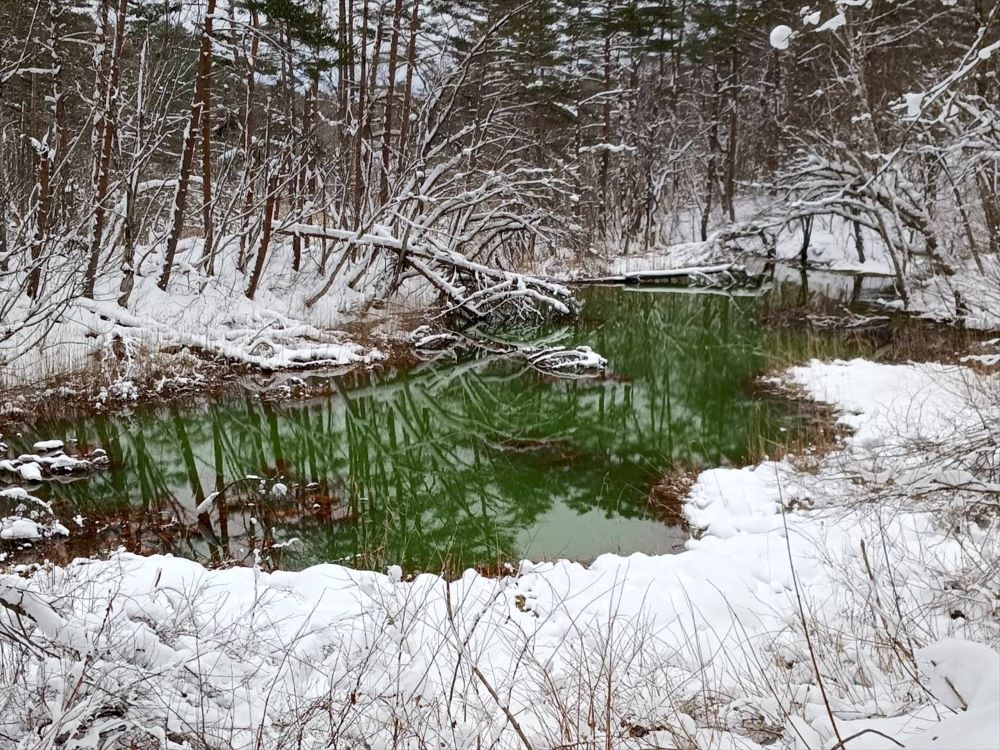
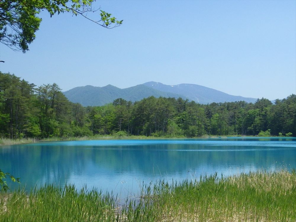
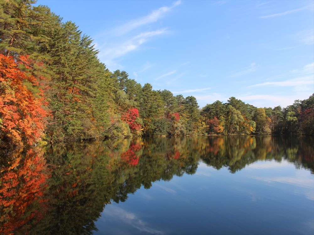
Goshikinuma Ponds
The Goshikinuma (lit., “colorful marshes”), are a cluster of about 30 ponds known for their turquoise, green, and copper hues. Around 300 of these shallow bodies of water formed following an eruption of Mt. Bandai in 1888. The eruption sent tons of debris cascading down the mountain’s northern slopes. The ponds formed in depressions that remained when the debris dammed several valleys.
The vivid, multicolored shades are believed to be caused by chemicals and mineral particles such as aluminum silicate in the water and sand. The colors are also affected by reflections of the surrounding landscape and differences in sediment and vegetation. Some of the ponds are very acidic, due to high levels of sulfates in the water, which is the result of the mountain’s volcanic activity. Some have a pH so low that they cannot support aquatic life.
Geologists believe water filters through to these ponds from lakes at higher altitudes. The Copper Pond (Akanuma) is a crater lake high on the northern slopes of Mt. Bandai. It is thought to be the source of springs that feed some of the ponds and affect their mineral content.
The 90-minute walk along the Goshikinuma Pond Trail passes 10 of these ponds.
Bishamonnuma
Bishamonnuma is the largest of the Goshikinuma ponds, a colorful cluster of around 30 shallow ponds and marshes formed when Mt. Bandai erupted in 1888 and triggered a landslide that dammed a nearby river.
Bishamonnuma appears either blue or green, depending on the light. The pond’s relatively low acidity allows plankton and aquatic plants, such as watermilfoil (Myriophyllum) and pondweed ( Potamogeton ) to flourish. Several species of fish, including Amur minnow and Japanese dace thrive here.
Bishamonnuma is the first pond encountered walking westwards along the trail that leads from the Visitor Center. It is the only pond on the trail at which you can hire a paddle boat for views from the water. The pond’s name comes from Bishamon, one of the four guardian deities in the Buddhist pantheon, and also one of Japan’s Seven Lucky Gods, which have been worshipped since the Muromachi period (1136-1573).
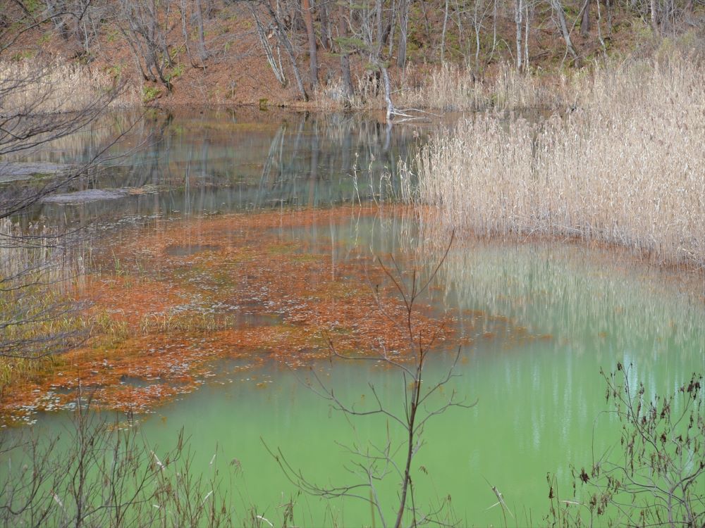
Akanuma
Akanuma (Red Pond) is part of the Goshikinuma Pond Group, a colorful cluster of around 30 shallow ponds and swamps formed when Mt. Bandai erupted in 1888 and triggered a landslide that blocked a nearby river.
It is fed by spring waters originating in the acidic, iron rich Copper Pond (also named Akanuma), a crater lake high on the northern slope of Mt. Bandai. The water, despite the pond’s name, usually appears greenish with only slight red hues. The red comes from iron rust residue that accumulates on the roots of the reeds and other aquatic plants growing in the pond.
Midoronuma
Midoronuma Pond (Deep Mud Pond) is part of the Goshikinuma Pond Group, a colorful cluster of around 30 shallow ponds and swamps formed when Mt. Bandai erupted in 1888 and triggered a landslide that blocked a nearby river.
Midoronuma is one of the smallest bodies of water on the Goshikinuma Trail. The pond is fed by multiple underground springs, varying the colors within the pond and creating a dappled effect. Color gradients range from blue green or yellow green to electric blues depending on variations in water quality, plant life, and the quality of the light.
Bentennuma
Bentennuma is the second largest of the Goshikinuma ponds, a colorful cluster of around 30 shallow ponds and marshes formed when Mt. Bandai erupted in 1888 and triggered a landslide that blocked a nearby river.
This blue, green, and milky white pond is one of the less acidic ponds of the group, so it is more likely to freeze over during the winter. A species of moss that grows in the pond, Drepanocladus fluitans , forms dense mats along the
bottom
The pond is named after Benten , the Buddhist goddess of water and the arts, one of Japan’s Seven Lucky Gods worshipped since the Muromachi period (1136-1573).
Rurinuma
Rurinuma (Lapis Lazuli Pond) is one of the Goshikinuma ponds, a colorful cluster of around 30 shallow ponds and marshes formed when Mt. Bandai erupted in 1888 and triggered a landslide that blocked a nearby river.
Rurinuma is a blue, green, and milky white pond. Experts believe this unusual color may come from the high levels of calcium and sulphate ions in the water. Drepanocladus fluitans moss growing in a rare mat formation on the pond floor may also affect the color. Like Bentennuma and Aonuma, this pond is fed by water from the highly acidic Copper Pond, a crater lake located high on the northern slope of Mt. Bandai. As a result, there is little plankton growth or aquatic life.
Aonuma
Aonuma (Blue Pond) is one of the most striking of the Goshikinuma
ponds, a colorful cluster of around 30 shallow ponds and marshes formed when Mt. Bandai erupted in 1888 and triggered a landslide that blocked a nearby river.
Aonuma’s deep blue color contrasts beautifully with both summer greens and autumn foliage. Plants overhanging the pond appear frosted where they have dipped into the water. This is due to a coating of aluminum silicate, an acidic compound in the water deposited during the eruption. Aluminum silicate is present in other lakes within the Goshikinuma cluster, but to a lesser degree.
The pond is too acidic for plankton or fish, but it supports extensive mats of moss called Drepanocladus fluitans.
Yanaginuma
Yanaginuma (Willow Pond) is one of the Goshikinuma ponds, a colorful cluster of around 30 shallow ponds and marshes that formed when Mt. Bandai erupted in 1888 and a subsequent landslide blocked a nearby river.
Yanaginuma is one of the largest of the Goshikinuma ponds. This emerald green pond has relatively mild acidity levels, meaning it can support plankton and other pond life, including fish such as Japanese dace ( Tribolodon hakonensis ) and wakasagi smelt(Hypomesus nipponensis)
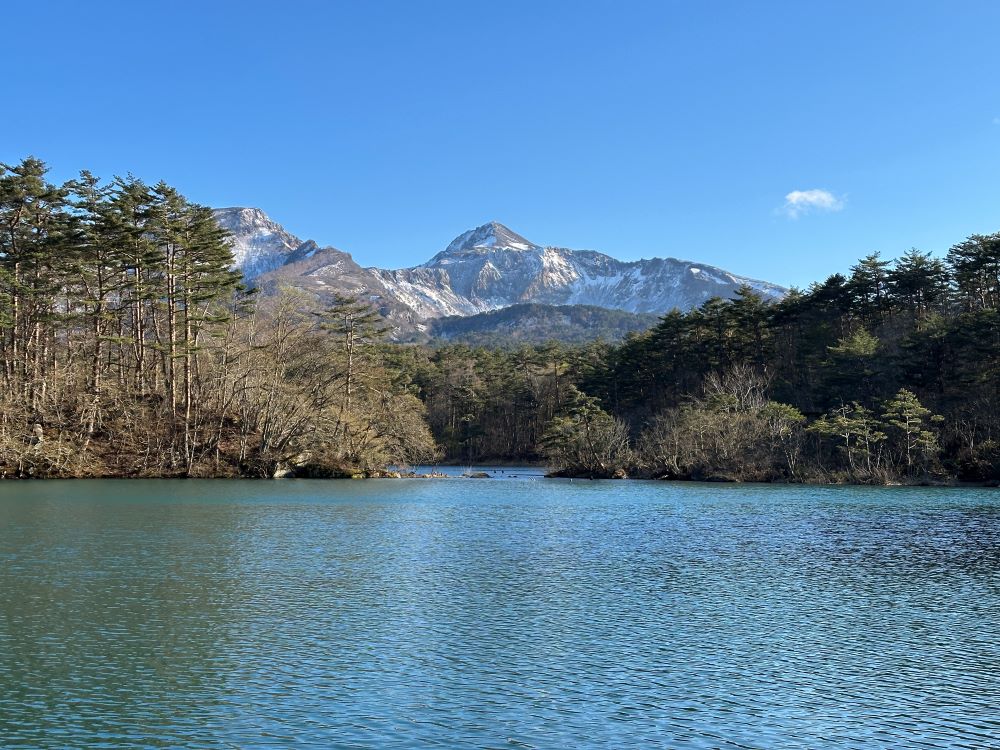
Nakasenuma
Nakasenuma was formed during the powerful 1888 eruption and partial collapse of Mt. Bandai. The event displaced vast quantities of soil and rock. This debris blocked river systems and created debris flow deposits. Water flooded into the depressions and d eposits, creating around 300 lakes and ponds, including Nakasenuma.
You can see the pond and Mt. Bandai from an observation deck, a stop on the Rengenuma Pond hiking trail (700 m) and Nakasenuma trail (1.2 km).
The observation point is a prime place for birdwatching. Species that inhabit the area include several varieties of flycatcher and bunting.
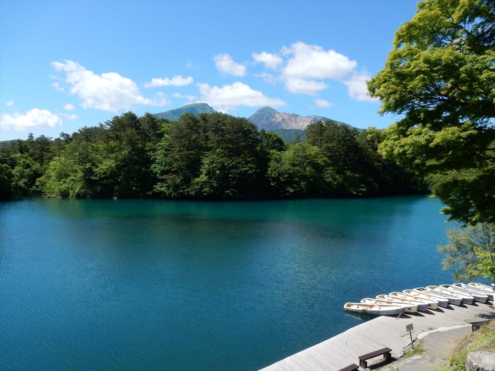
Lake HIbara
Lake Hibara is the largest lake in the Bandai Kogen Highlands, covering 10.7 square kilometers. It was formed during the 1888 eruption of Mt. Bandai. The landslide that followed destroyed entire villages and dammed up valleys, forming around 300 lakes and ponds.
On the northern shore of the lake there is a torii gate from Oyamazumi Shrine that survived the eruption. Another torii gate from the same shrine is submerged in the lake, occasionally piercing the surface when water levels drop. Small islets dotting the lake are comprised of volcanic debris from the eruption.
The lakeside is popular for camping, with several campsites along the shore. There is a path around parts of the lake that is ideal for walking or cycling. Between late April and late November, explore the lake from the water by speed boat, or hire a cano e or pedal boat. Ice fishing for smelt is a popular pastime after the lake freezes over.
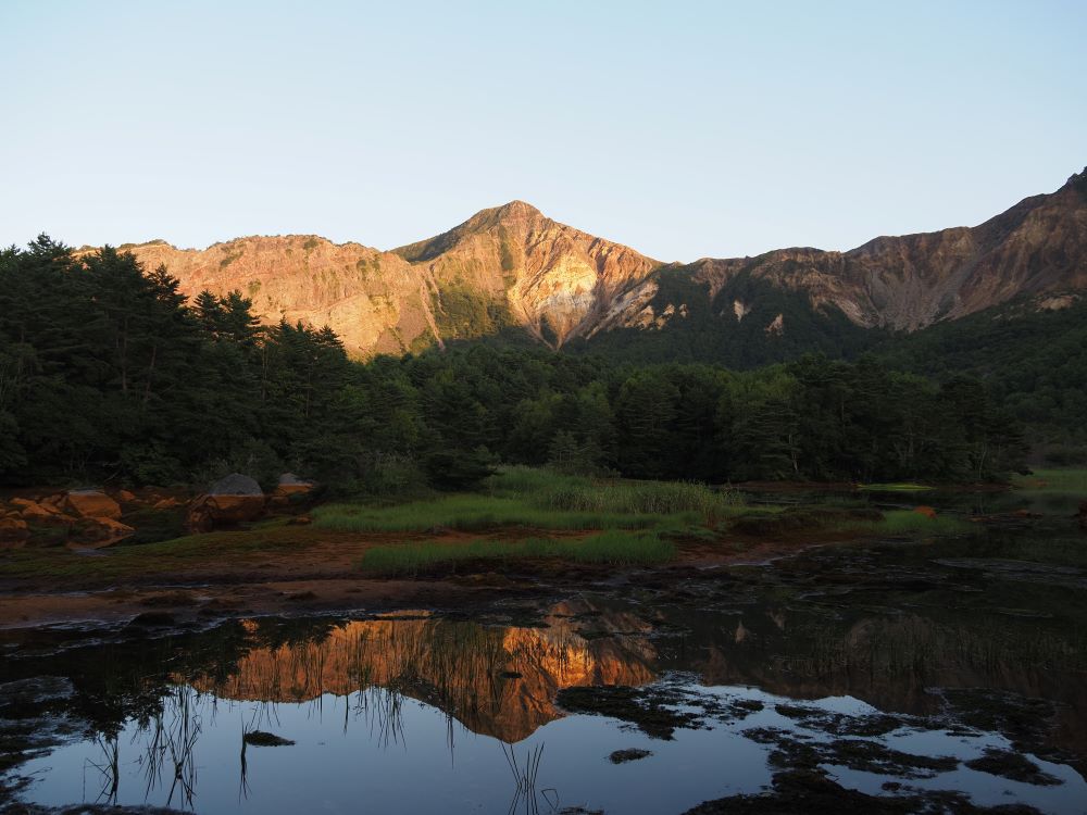
Akanuma(Copper Pond)
Akanuma (Copper Pond) is a rust hued, horseshoe shaped crater pond, created during the eruption and partial collapse of Mt. Bandai in 1888. It lies in a forested caldera on the northern flanks of the now inactive volcano.
High levels of iron hydroxide in the lake give the pond its coppery red color. The acidity levels are too high to support aquatic life. Fumaroles, openings in the side of Mt. Bandai visible from the pond, emit gases.
Akanuma (Copper Pond) has an elevation of over 1,000 meters above sea level. Geologists believe its water seeps downward through the earth and emerges at lower altitudes as springs that run into the colorful Goshikinuma cluster of ponds some 300 meters be low, one of which is similarly named Akanuma (Red Pond). Minerals enter the lakes in varying quantities, altering the color, acidity, and ecosystem of each pond. When Akanuma (Copper Pond) freezes over, you can hire a guide to show you a safe route to
its “Yellow Falls,” a frozen waterfall with a golden, sulfur color.
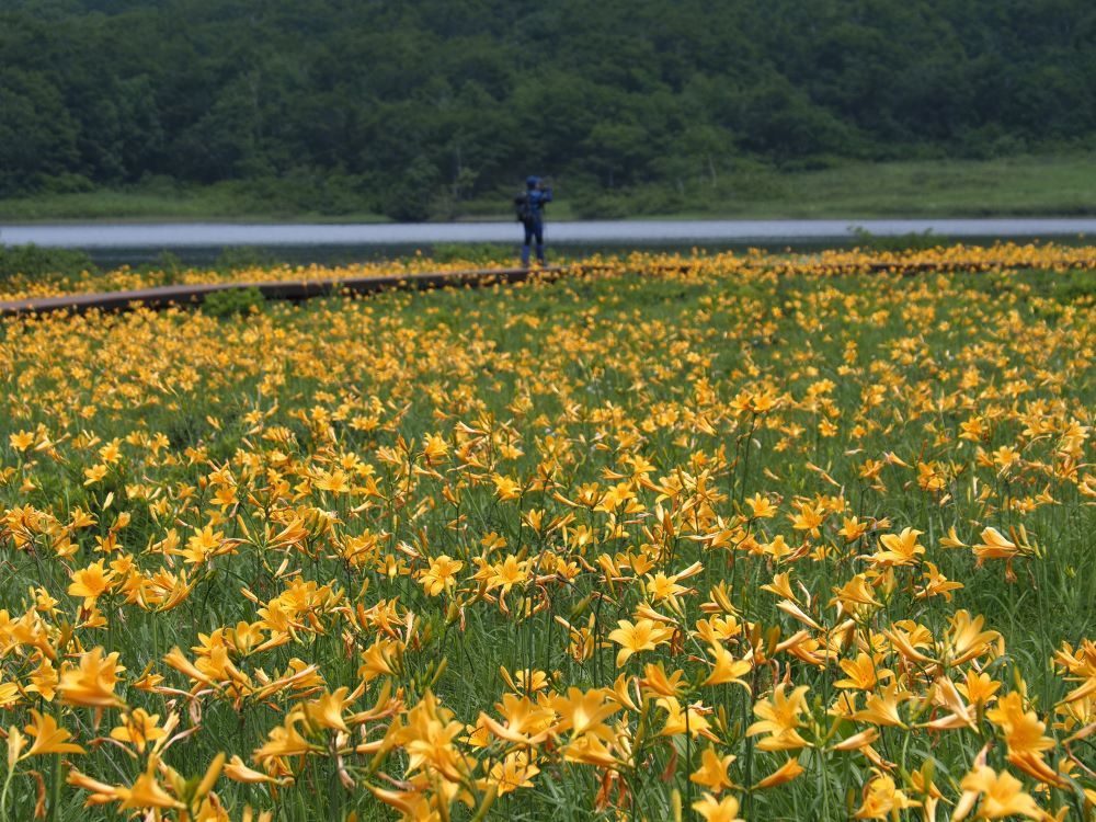
Oguninuma
Oguninuma is a lake that formed 400,000 years ago when nearby Mt. Nekomagadake erupted and partially collapsed. The lake is famous for its surrounding wetlands, which are designated a National Natural Monument. Mid-June is the best time to see azaleas and late June to early July is the best time to see bright yellow daylilies bloom here. An 800-meter boardwalk runs through the marshes and around the pond.
The Oguninuma Marshland Trail can be reached from either the “Oguni Sese ragi Trail” or the “Oguni Panorama Trail”.
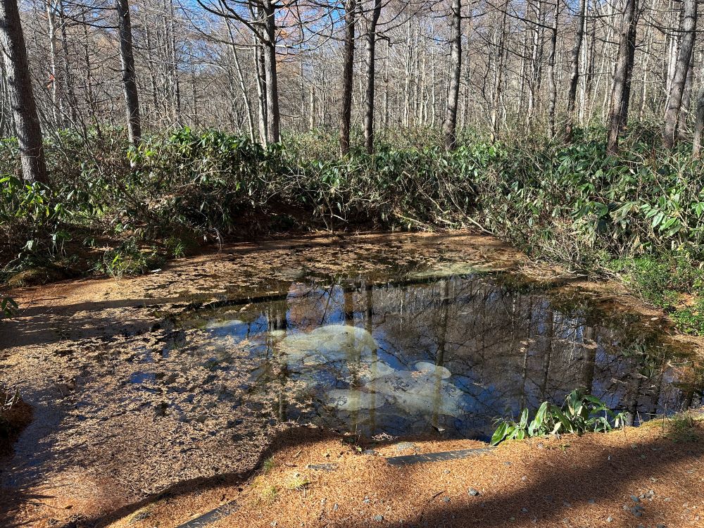
Hyakkan Simizu Spring
The Hyakkan Shimizu Spring is a clear spring known for its cool, drinkable water. It is at an altitude of 1,300 meters on a trail between Mt. Nishi Daiten and Mt. Nishi Azuma.
The spring is surrounded by towering beech trees and is the source of the Onogawa River and the enormous Onogawa Fudo waterfall. Hikers can refill their bottles using a scoop placed next to the pool.
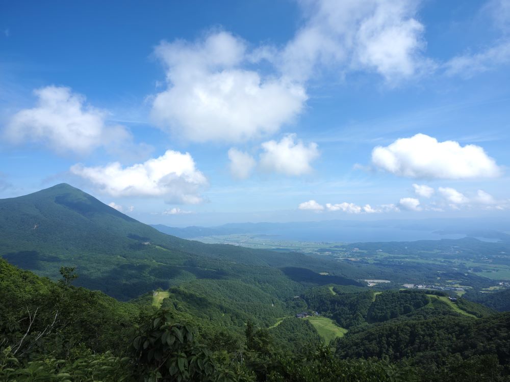
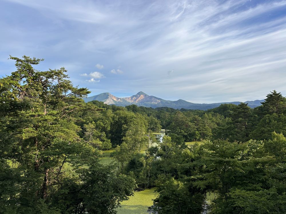
Mt.Nekomagadake(View from Mt.Nekomagadake)
Mt. Nekomagadake is a 1,404-meter-tall inactive volcano. It erupted around 400,000 years ago, causing the collapse of one of its peaks and the formation of lake Oguninuma.
Mt. Nekomagadake translates to “evil cat peak.” The name is thought to derive from several cat myths surrounding the mountain. The most common story describes a vicious cat that inhabited the mountain. It would prey on human flesh, disguising itself as a human to lure people closer. Buddhist monk Kukai (posthumous name Kobo Daishi; 774- 835), is said to have trapped the cat within a massive pile of boulders on a lower peak of the mountain.
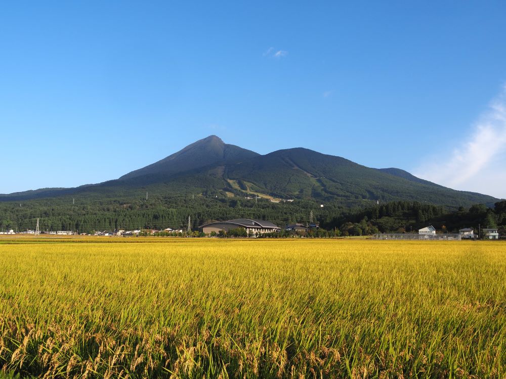
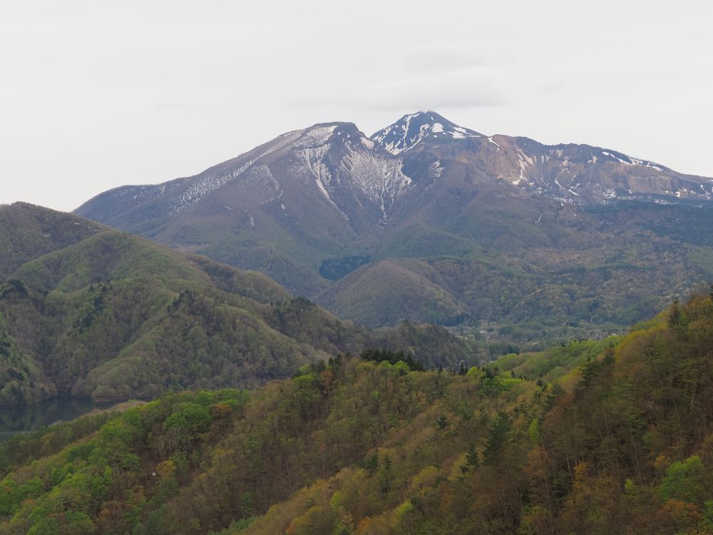
Mt. Bandai
Mt. Bandai is a 1,816-meter stratovolcano, a volcano built up of layers of lava and ash,
that has been dramatically reshaped by two large eruptions.
Around 2,500 years ago, Mt. Bandai was symmetrical, but volcanic activity caused
the peak to collapse in on itself, creating the Numanodaira Caldera.
In 1888 it erupted again in a devastating steam blast eruption, an explosion that
occurs when water beneath the ground or on the surface is heated by magma or lava. No lava was discharged, but it was powerful enough to cause the collapse of one of the
vol cano’s four peaks, Ko Bandai (around 1,800 meters, on the north side of the mountain), and triggered a large-scale landslide.
The landslide destroyed 11 communities and entirely reshaped the north side of the
mountain, known today as Urabandai. The landslide that followed destroyed entire
villages and dammed up valleys, forming around 300 lakes and ponds. Today, their beauty is a major attraction in Bandai Asahi National Park.
Vegetation in the area was badly damaged but grew back quickly, in part because of
extensive, government backed reforestation projects. A lava eruption would have likely
caused more long term damage to the ecosystem.
Six trails of varying difficulty lead to the top of the mountain. From the top you can
see where Ko Bandai collapsed and the surfaces of lakes and ponds. Since the early
seventh century, these trails have been used by practitioners of Shugendo, a folk religion based on mountain worship, that involves enduring extreme physical hardships. During climbing season, between late May and October, you can follow their footsteps up the mountain’s trails.
Mt. Bandai is made up of hardened layers of lava, ash, pumice, and fragmented rock.
Its partial collapse offers a rare opportunity to see a cross section of this type of volcano, which makes it an important geological site. Mt. Bandai now consists of three peaks, Bandai (1,816 meters), Kushigamine (1,636 meters) and Akahaniyama (1,430 meters).
Terrain Changes following the Eruptions
Mt. Bandai was originally a symmetrical stratovolcano, a volcano built up of layers of
lava and ash. Volcanic activity 2,500 years ago caused the top of the mountain to collapse in on itself, creating the 1.2 kilometer wide 350 meter deep Numanodaira Calde ra. Before the collapse, it had four peaks of between 1,430 meters and 1,816 meters in height: Oo Bandai, Kushigamine, Akahaniyama, and Ko Bandai.
A phreatic (steam blast) eruption in 1888 destroyed the former summit of Ko Bandai
or “Little Bandai.” The blast left the mountain with only three peaks, triggered a
devastating landslide, and cast debris throughout the area. Hikers to this now inactive
volcano can see where the collapse of Ko Bandai occurred and look out across the
surrounding area with its many ponds and lakes (around 300) that were formed when the landslide blocked river valleys.
The mountain is carefully monitored for activity to predict and prepare for any future
eruptions.