Bandai &
Urabandai Area

-
Mt. Bandai
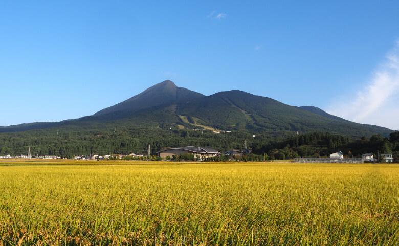
Mt. Bandai is an active stratovolcano. The mountain as seen from the Urabandai area is notable for its partially collapsed peak which is the result of a major eruption in 1888.The same eruption triggered rock avalanches that completely buried five villages in Urabandai and dammed up valleys. This led to the formation of numerous bodies of water including the Goshikinuma Ponds. These polychromatic ponds are colored by a combination of volcanic sediment, minerals, and iron oxide that have leached into the lake beds over the years. Lake Hibara formed when a valley was blocked up by debris and filled with water. The remains of Hibara Village lie at the bottom of the lake.
-

Akanuma (Copper Pond)
Akanuma is a rust-hued, horseshoe-shaped crater pond, created during the eruption and partial collapse of Mt. Bandai in 1888. It lies in a forested caldera on the northern flanks of the now inactive volcano. High levels of iron hydroxide in the lake give the pond its coppery red color. The acidity levels are too high to support aquatic life. Fumaroles, openings in the side of Mt. Bandai visible from the pond, emit gases.
-
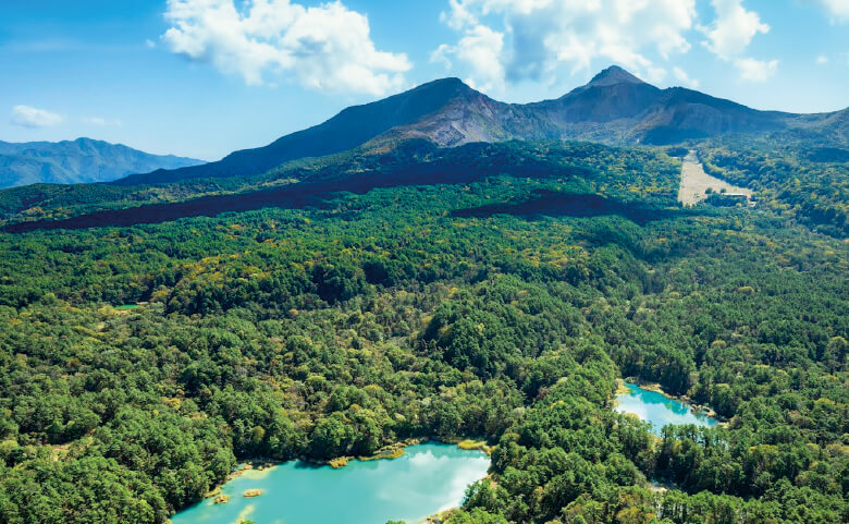
Goshikinuma Ponds
The Goshikinuma Ponds are a collection of around 30 ponds in the foothills of Mt. Bandai. They formed after Mt. Bandai erupted in 1888. The eruption triggered a landslide which dammed up rivers and valleys and destroyed the surrounding forests and villages. Community efforts helped to regenerate the forests and restore the natural environment.
The colorful ponds
The ponds have distinct coloration caused by volcanic sediments and mineral particles such as aluminum silicate, iron, copper, and manganese. Their colorful copper, blue, and green hues change subtly according to light conditions, shifts in sediment, reflections on the surface of the water, and other factors.https://www.urabandai-inf.com/en/?page_id=141
https://bandaiazuma-inawashiro.com/qr/ -

Lake Hibara
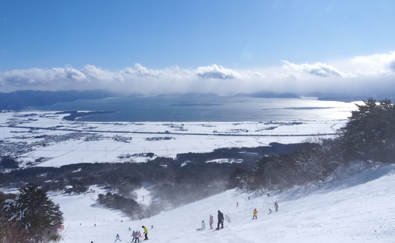
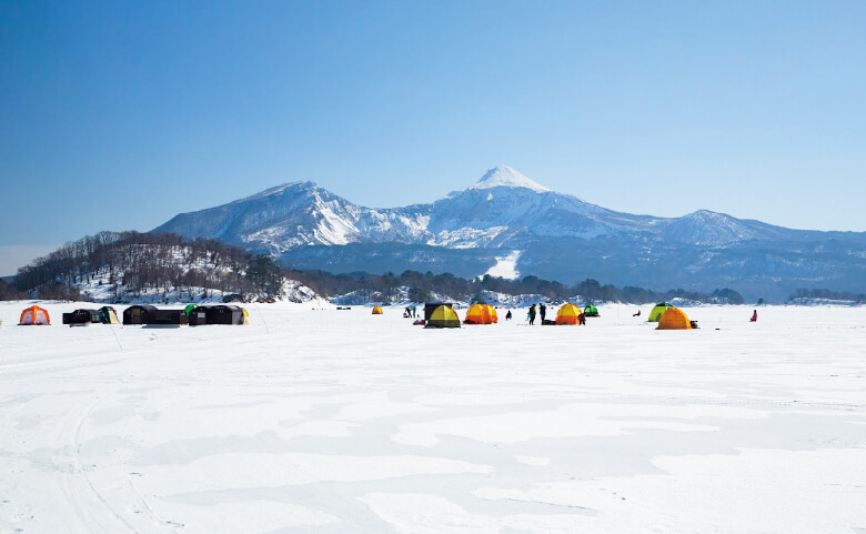
Lake Hibara is the largest lake in the Bandai Kogen Highlands, covering 10.7 square kilometers. It was formed during the 1888 eruption of Mt. Bandai. The landslide that followed destroyed entire villages and dammed up valleys, forming around 300 lakes and ponds. On the northern shore of the lake there is a torii gate from Oyamazumi-jinja Shrine that survived the eruption. Another torii gate from the same shrine is submerged in the lake, occasionally piercing the surface when water levels drop. Small islets dotting the lake are comprised of volcanic debris from the eruption. The lakeside is popular for camping, with several campsites along the shore. There is a path around parts of the lake that is ideal for walking or cycling. Between late April and late November, explore the lake from the water by speed boat, or hire a canoe or pedal boat. Ice fishing for smelt is a popular pastime after the lake freezes over.
-

Nakasenuma Pond
Nakasenuma Pond is one of many ponds and lakes created after the 1888 eruption of Mt. Bandai. This level, 1.2-kilometer trail takes hikers past small hills formed by debris flows after the eruption, to an observation deck near the pond. The observation deck affords a view of the pond with Mt. Bandai in the background. A crater is visible in the side of the mountain that was formed when one of Mt. Bandai's peaks collapsed during the eruption.
-
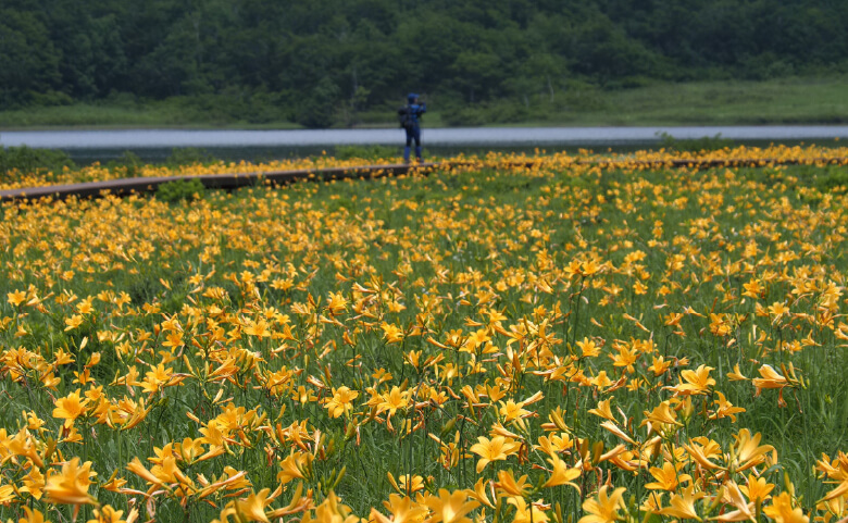
Oguninuma Pond
Oguninuma Pond is a pond that formed 400,000 years ago when nearby Mt. Nekomagadake erupted and partially collapsed. The lake is famous for its surrounding wetlands, which are designated a National Natural Monument. Mid-June is the best time to see azaleas and late June to early July is the best time to see bright yellow daylilies bloom here. An 800-meter boardwalk runs through the marshes and around the pond.
The Oguninuma Marshland Trail can be reached from either the Oguni Seseragi Trail or the Oguni Panorama Trail.https://www.urabandai-inf.com/en/?page_id=24986
https://www-tif-ne-jp.translate.goog/yamafuku/course/course-oguni.html -

Urabandai Visitor Center
Urabandai Visitor Center is a facility that presents the natural environment of Bandai-Asahi National Park in an easy-to-understand manner, and aims to promote interest in nature among the large number of people that visit the Urabandai area.
DATA
Open:
9:00 - 17:00 (Summer period, April 1 - November 31)
9:00 - 16:00 (Winter period, December 1 - March 31)
Closed Tuesdays (if coinciding with a national holiday, the next day)End and beginning of year
Address: Kengamine Hibara1093-697, Kitashiobara Village, Yama County, Fukushima Prefecture
Contact: 0241-32-2850 (Tel)